Photo gallery
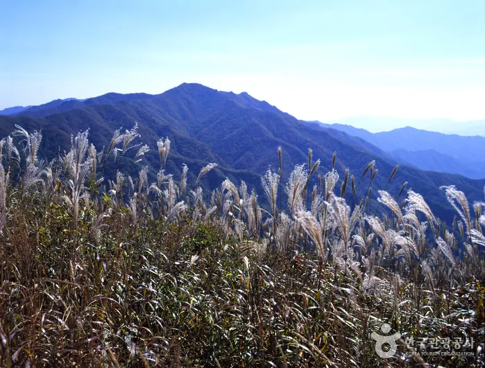
Jangansan County Park (장안산군립공원) · © KTO · KOGL Type 3
Korea
Jangansan County Park
Situated in Jangsu-gun in Jeollabuk-do, Jangansan Mountain (alt. 1,237 m) was officially designated a county park in 1986. Deoksan Valley Stream, which originates in the southwestern part of Jangansan Mountain and flows into Yongnimcheon Stream, is famous for the Deoksanyongso Waterfall Basins and the 20 or so large rocks that dot its banks. The sprawling fields of reeds along the East Ridge are also a major draw, undulating like waves of gold in the crisp autumn wind. In particular, the east hiking path on Jangansan Mountain is lined with a wide field of silver grass making it popular among hikers. Official location: Jangan-ri, Jangsu-gun, Jeonbuk-do. Closure information: N/A (Open all year round). Parking: Available. Information contact: • 1330 Travel Hotline: +82-2-1330 (Korean, English, Japanese, Chinese) • For more info: +82-63-350-2445.
Why go
Situated in Jangsu-gun in Jeollabuk-do, Jangansan Mountain (alt. 1,237 m) was officially designated a county park in 1986. Deoksan Valley Stream, which originates in the southwestern part of Jangansan Mountain and flows into Yongnimcheon Stream, is famous for the Deoksanyongso Waterfall Basins and the 20 or so large rocks that dot its banks. The sprawling fields of reeds along the East Ridge are also a major draw, undulating like waves of gold in the crisp autumn wind. In particular, the east hiking path on Jangansan Mountain is lined with a wide field of silver grass making it popular among hikers. Official location: Jangan-ri, Jangsu-gun, Jeonbuk-do. Closure information: N/A (Open all year round). Parking: Available. Information contact: • 1330 Travel Hotline: +82-2-1330 (Korean, English, Japanese, Chinese) • For more info: +82-63-350-2445.
Quick highlights
- County park around Jangansan Mountain
- Korean 'gunlip' park category
- Hiking trails and scenic ridges
- Protected forest landscape
- Half-day to full-day hike
How to enjoy
Hiking course: Course 1: Muryonggogae Pass → Jangansan Mountain (3.2 km, 1 hr 30 min) Course 2: Milmokjae Pass → Jangansan Mountain (9 km, 4 hr 30 min) Course 3: Jisogol Valley → Jangansan Mountain (3 km, 1 hr 30 min) Course 4: Goeomokdong → Jangansan Mountain (5 km, 2 hr 30 min) Course 5: Yeonju → Jangansan Mountain (5.7 km, 2 hr 30 min) Course 6: Beomyeondong → Jangansan Mountain (5.5 km, 2 hr 30 min) Areas open to visitors: Muryeonggogae Pass – Jangansan Mountain (2.5 km) These highlights come from the Korea Tourism Organization and can change — confirm facilities, courses, and access on the official channel before you visit.
Practical tips
Parking: Available. These details come from the Korea Tourism Organization and can change — confirm parking, age conditions, and program availability on the official channel before you visit.
Visitor services
Restrooms: Available These service details come from the Korea Tourism Organization and can change — confirm restrooms, interpretation, and reservation requirements on the official channel before you visit.