
POPULAR
Gyeongsangnam-do
Tourist landmarkJinjuseong Fortress
Why go: Iconic stop curated by Korea Tourism Organization
ROOT
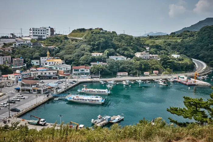
View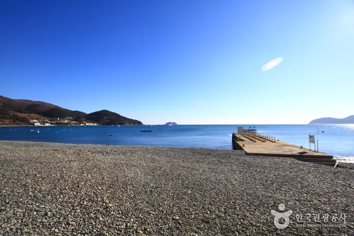
Geojedo Island (거제도) · © KTO · KOGL Type 3
Gyeongsangnam-do
Geojedo Island is a curated attraction in Korea — full details, hours, and access info on the official Korea Tourism page.
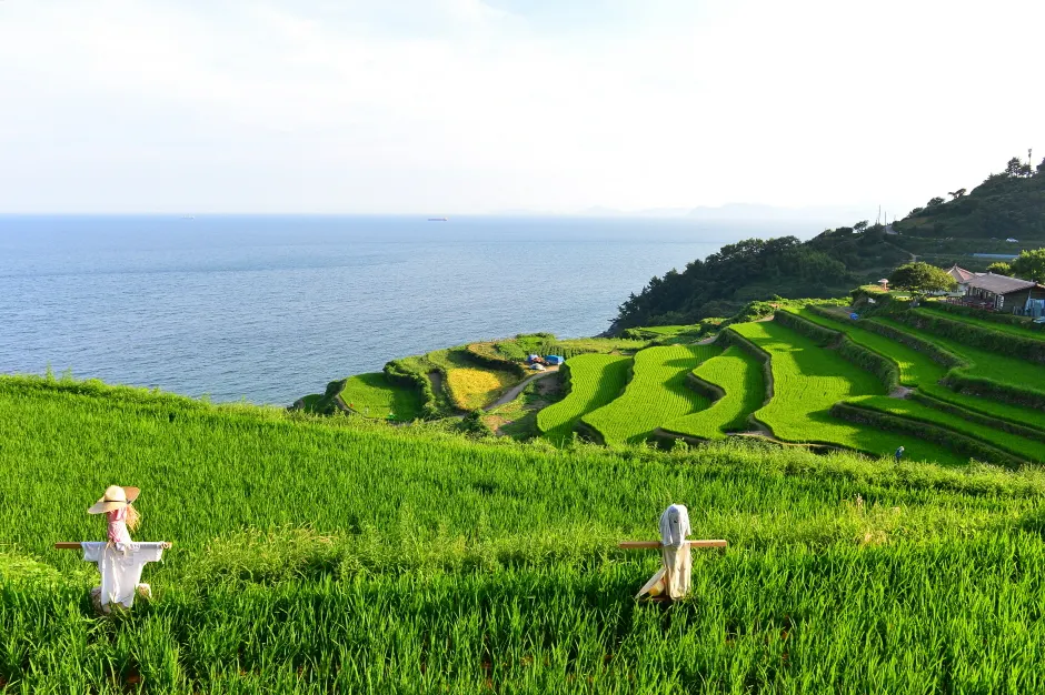
Geojedo is Korea's second-largest island, a mountainous and deeply indented coast in southern Gyeongsangnam-do, reached now by the spectacular Geoga Bridge from Busan. The island combines a heavy industrial side — Daewoo and Samsung shipyards on the east coast — with the dramatic Hallyeohaesang Marine National Park scenery on the south and west: limestone-bedded inlets, the Windy Hill cliff, the famous Sinseondae rocks at Haegeumgang, and the sand-and-pebble Hakdong Mongdol Beach. A full day or two-day loop drive is the standard way to see it, often starting with a ferry to nearby Oedo Island for its botanical garden. Best mid-spring or autumn.
Other places in Gyeongsangnam-do that pair well with this visit.
Gyeongsangnam-do
Tourist landmarkWhy go: Iconic stop curated by Korea Tourism Organization
Gyeongsangnam-do
Local favoriteWhy go: Iconic stop curated by Korea Tourism Organization
Gyeongsangnam-do
Local favoriteWhy go: Iconic stop curated by Korea Tourism Organization
Gyeongsangnam-do
Local favoriteWhy go: Iconic stop curated by Korea Tourism Organization
Gyeongsangnam-do
Local favoriteWhy go: Iconic stop curated by Korea Tourism Organization
Gyeongsangnam-do
Local favoriteWhy go: Iconic stop curated by Korea Tourism Organization
Gyeongsangnam-do
Local favoriteWhy go: Iconic stop curated by Korea Tourism Organization
Gyeongsangnam-do
Local favoriteWhy go: Iconic stop curated by Korea Tourism Organization
Gyeongsangnam-do
Local favoriteWhy go: Iconic stop curated by Korea Tourism Organization
Gyeongsangnam-do
Local favoriteWhy go: Iconic stop curated by Korea Tourism Organization
Gyeongsangnam-do
Local favoriteWhy go: Iconic stop curated by Korea Tourism Organization
Gyeongsangnam-do
Local favoriteWhy go: Iconic stop curated by Korea Tourism Organization